Baroro Watershed
The Baroro Watershed is a river basin with a total land area of 19,407.52 hectares located in the northeastern section of Luzon Island and the northeastern part of La Union. It is found between the latitudes of 16° 37′ 0.48″ and 16° 44′ 11.04″ north and the longitudes of 120° 20′ 12.48″ and 120° 32′ 16.8″. The Maragayap Watershed borders the Baroro River Basin to the north, the Amburayan Watershed to the east, the Gatay Watershed to the west, and the Bauang Watershed to the south.
The Baroro Watershed is divided into nine (9) subwatersheds covering a total area of 19,407.51 hectares. Subwatershed 3 has the largest coverage area, accounting for 27.60% of the total area, followed by Subwatershed 4 with 24.31%. Subwatershed 6 has the least coverage area, covering approximately 604.39 hectares of the Baroro Watershed’s total area of 19,407.51 hectares.
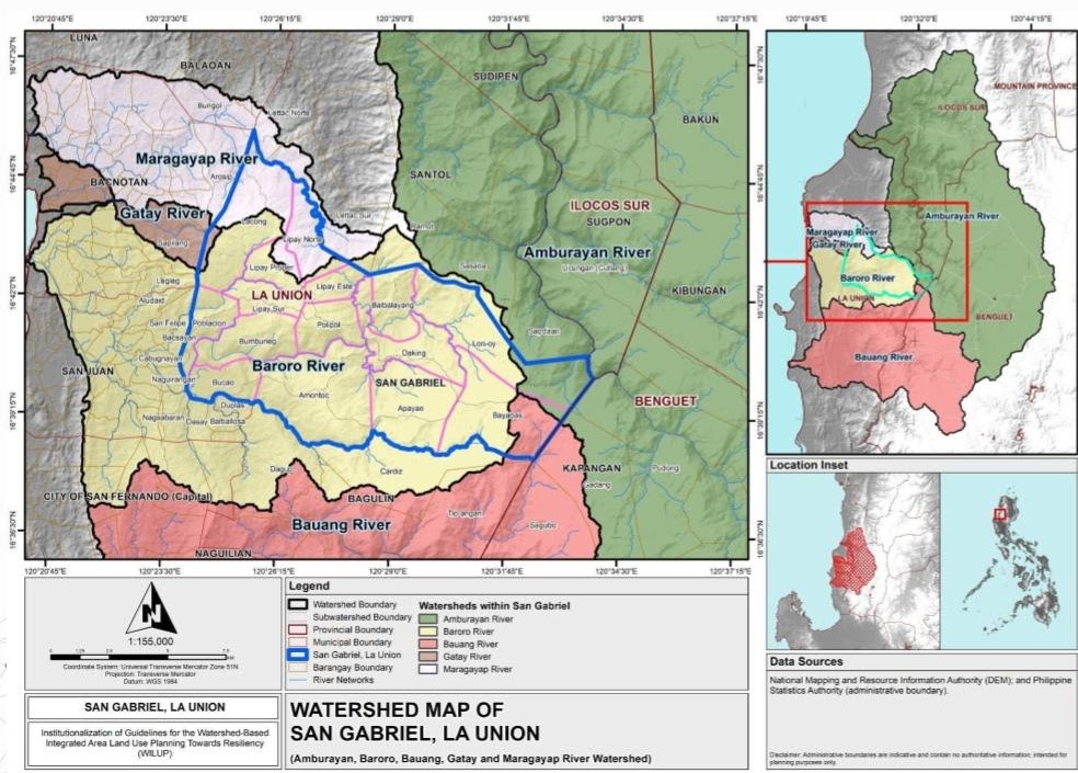
Photo Courtesy by:
In terms of administration coverage, the Baroro Watershed has comprised of five (5) municipalities and one (1) city in the province of La Union; Bacnotan, Bagulin, San Gabriel, and Santol, and the City of San Fernando, respectively. San Gabriel has the largest area coverage, accounting for approximately 50.77% of the entire watershed area, whereas Santol has the least area coverage with only 505.29 hectares of the watershed area or 2.60%.
About San Gabriel, La Union
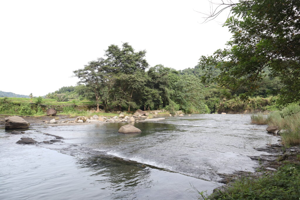
Photo Courtesy by: WILUP staff
San Gabriel, La Union
San Gabriel is one of nineteen (19) municipalities in the province of La Union. San Gabriel is located on the island of Luzon, specifically in the Ilocos Region (Region 1), at approximately 16° 40′ north and 120° 24′ east. It covers a total land area of 12,192.20 hectares and is divided into fifteen (15) barangays, namely, Poblacion, Bumbuneg, Bucao, Amontoc, Apayao, Daking, Balbalayang, Lon-oy, Bayabas, Polipol, Lipay Sur, Lipay Este, Lipay Norte, Lipay Proper, and Lacong. Barangay Poblacion is the municipality of San Gabriel’s lone urban barangay.San Gabriel is one of five (5) municipalities in La Union that encompasses three (3) major watersheds and two (2) minor basins. The primary river basins through San Gabriel are Amburayan, Baroro, and Bauang. Meanwhile, Gatay and Maragayap are the two (2) smaller watersheds that encompass within the municipality of San Gabriel.
Collaboration of WILUP Project and the Municipal Government of San Gabriel, La Union
The Institutionalization of Guidelines on Watershed Integrated Area Land Use Planning (WILUP) Towards Resiliency with the UPLB College of Forestry and Natural Resources (CFNR) and the Municipal Government of San Gabriel, La Union entered a Memorandum of Agreement with the project goal of assisting the Municipality of San Gabriel through effective planning and development of various planning tools such as Integrated Water Management Plan (IWMP), Comprehensive Land Use Plan (CLUP), Comprehensive Development Plan (CDP), Ecological Profile (EP), Zoning Ordinance (ZO), Enhanced Local Climate Change Adaptation Plan (e-LCCAP), Disaster Risk Reduction and Management Plan (DRRMP), Forest Land Use Plan (FLUP), E-LCCAP.
Pilot Site Identification
Site Coordination
Initial Stakeholders Identification
Secondary Data Collection
Site Visit and Project Presentation
Stakeholder's Consultation and Workshop
Presentation of Situational Analysis
Implementation of Project Activities